Nestled in the heart of Stirlingshire on the edge of the Carron Valley, the North Third Reservoir offers a tranquil escape from the hustle and bustle of everyday life. This hidden gem, surrounded by lush forests and rolling hills, is the perfect spot for nature lovers and avid walkers alike, it’s location ensures a quiet and peaceful walk, giving you time to appreciate your surroundings. This walk is a bit of a family favourite, so I have done it a number of times before.
Getting There
North Third Reservoir is located just a short drive from the historic city of Stirling and can be accessed via a minor road from the M9 or M80, depending on your direction. Google Maps will guide you straight to the parking spots. Ample parking is available near the reservoir in one of several rough laybys along the road near the bridge over the tiny Bannock Burn. There is no public transport to this walk.
The Walk
Start Point: Laybys near bridge over Bannock Burn on minor road
Distance: 3.8miles
Time: 2hrs (Weather was a bit damp and the path slippy in parts)
Difficulty: Moderate walk, steep uphill until the plateau, then steep deep steps down the other side. Otherwise flat. Paths can be a little muddy so appropriate footwear is required.

This walk starts at an unassuming but marked gate opposite the layby where you parked. The path is well-defined but can be slippy and is a bit narrow as you start the climb. The easy part of this walk is you need to keep the reservoir on your left the whole time, as it’s a circular route.
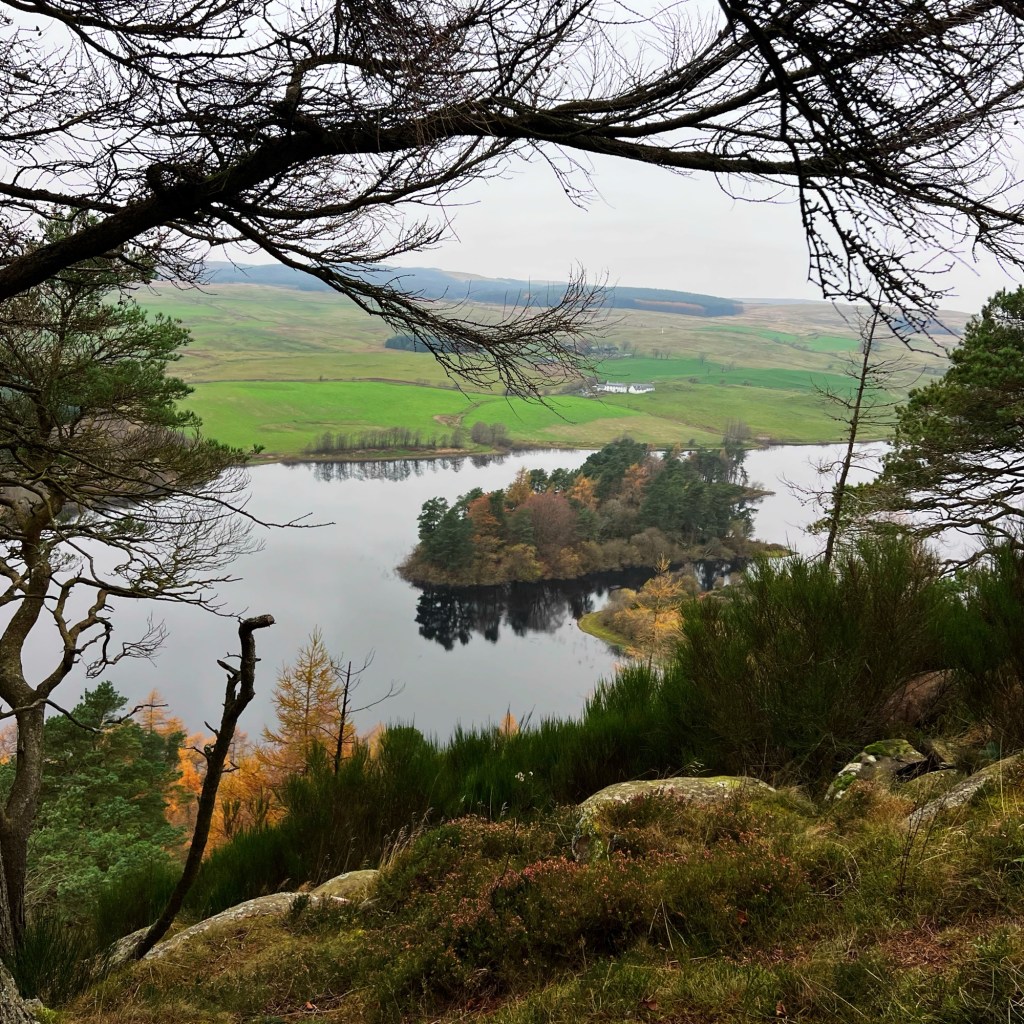
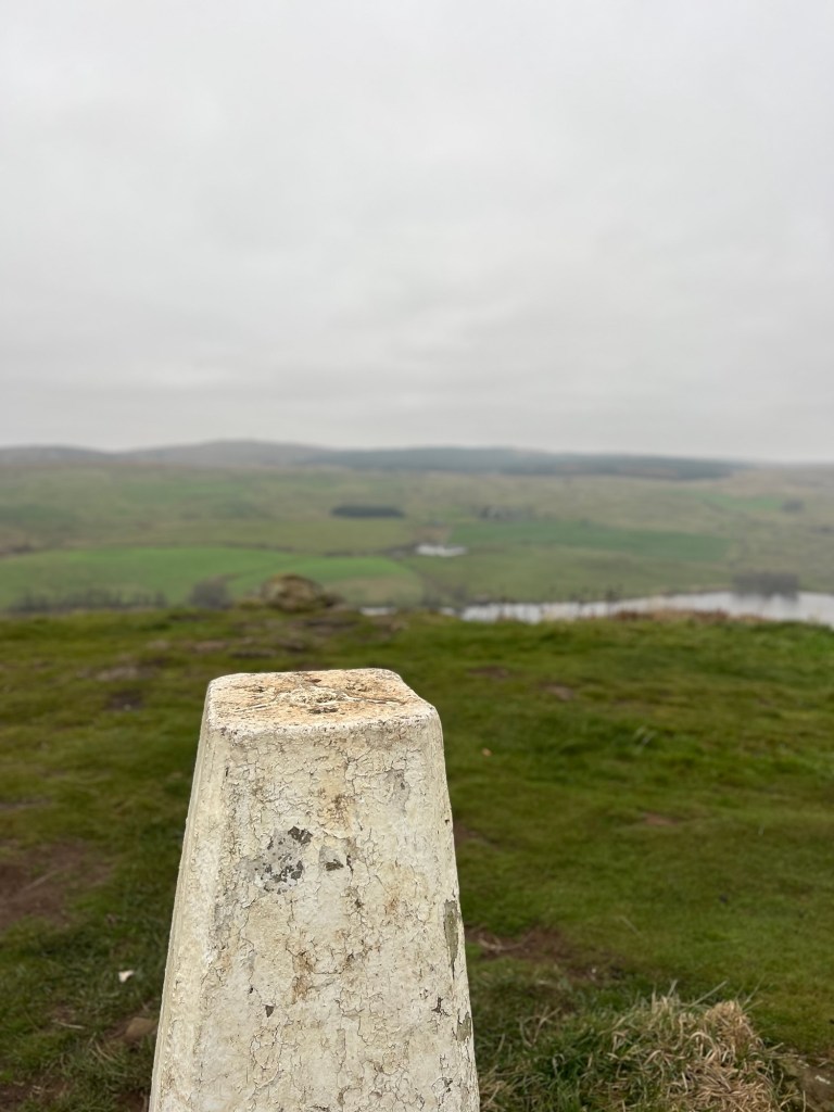
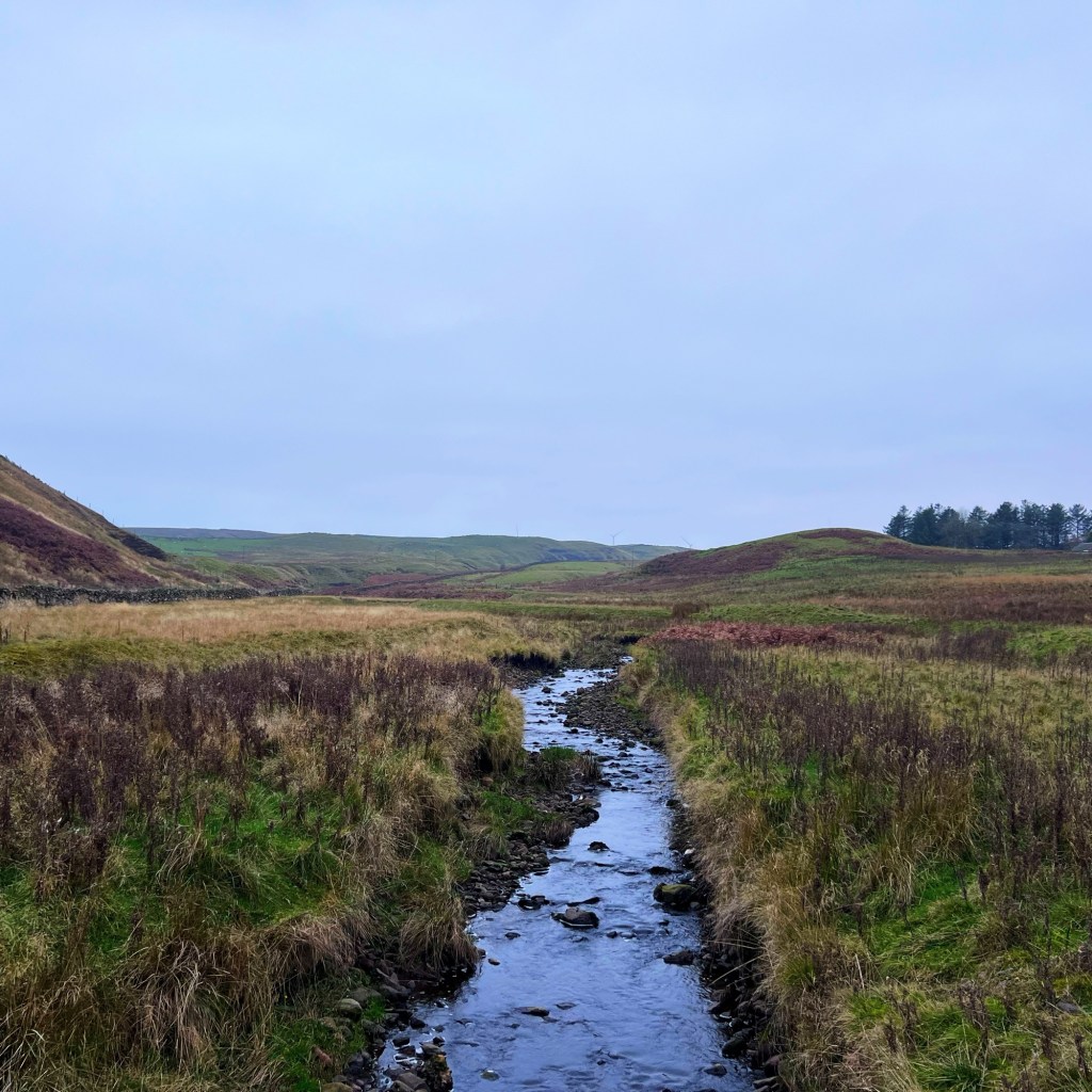
The path goes through a wooded area, and after about 15 minutes of climbing, it starts to widen and flatten out a bit. What you think is the ‘peak’ isn’t. Keep walking for about another 5 minutes and you will reach a trig point and a great viewpoint over the reservoir. The stunning panoramic view of the reservoir is the highlight of the walk; the calm and reflective waters mirror the surrounding trees and hills, creating a picture-perfect scene, even on the dreichest of days, when it becomes moody.
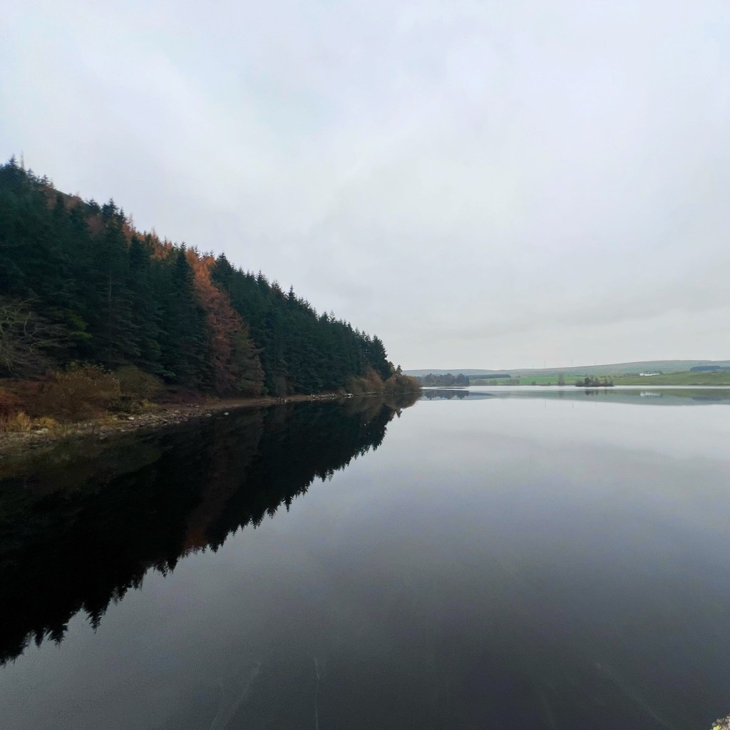
Walking on from the trig point, you are tracing the contour of the edge of the cliff. The path goes up and down for a bit and then back into the forest again. The path then comes to a fork junction, and you have a choice: keep going, which is said to be a gentler descent to the reservoir, or do what we did and head down through the trees and down a very steep and deep set of steps. It was not fun, and care should be taken whether it’s wet or dry!
Once at the bottom, you walk through another wooded area. The path can be quite muddy and sometimes a bit flooded, so take care not to slip. Finally, you reach the water. Here, the path crosses over the end of the reservoir and joins a slightly better path on the other side.

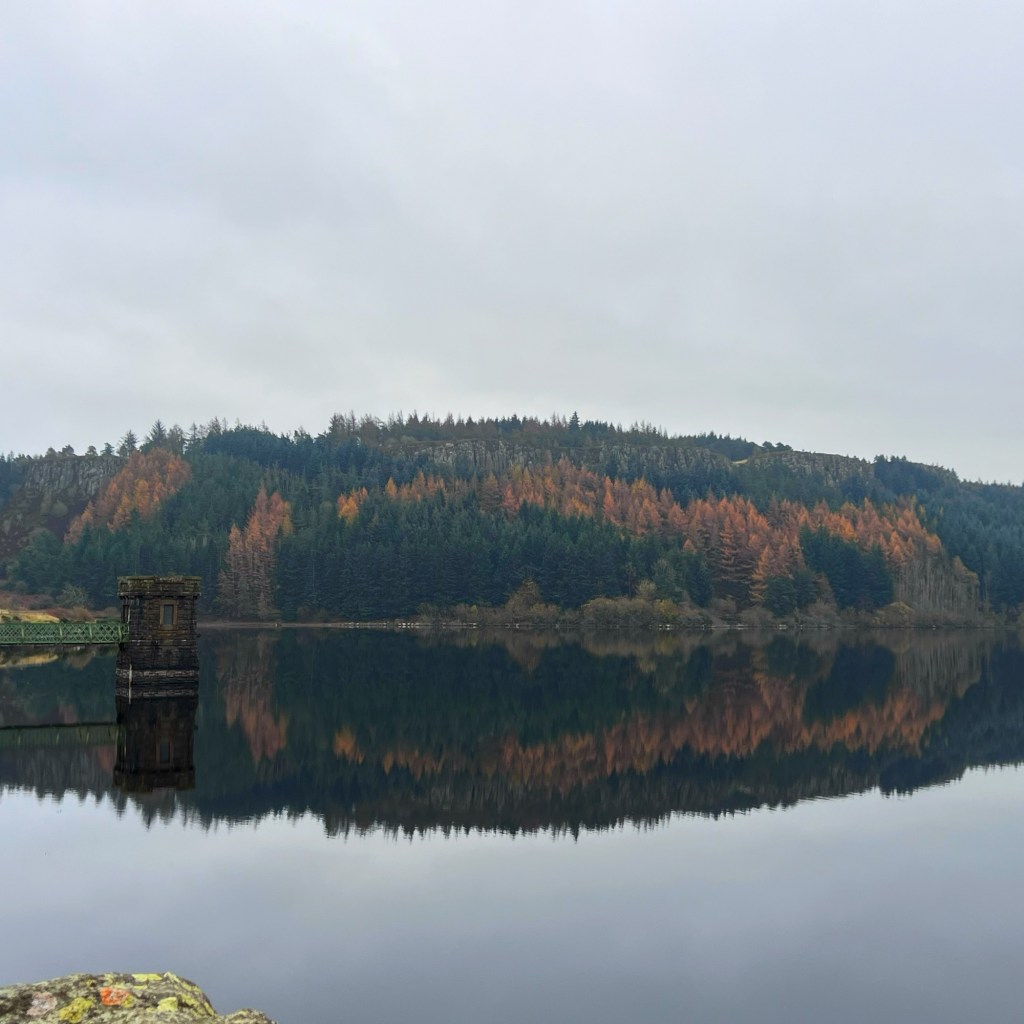
The rest of the walk follows the water’s edge, with views up to the cliffs you have just walked along. You pass little beachy areas where people have had BBQs or fires in the summer, and some parts of the path are replaced by boardwalk. As you approach the end of the reservoir, you come to a relatively newly built bridge. Cross this and you join the road again. You can continue around the reservoir, but we came off at the bridge and walked up the road back to the car, crossing over the Bannock Burn.
Wildlife Encounters
Keep your eyes peeled for local wildlife as you meander along the path. You might spot ducks gliding gracefully on the water, herons fishing along the shore, or even a deer darting through the woods. The reservoir is a haven for birdwatchers, so be sure to bring your binoculars if you’re a keen birdwatcher. Not being the best bird watcher, we did spot a heron and some geese!
Final Thoughts
Depending on how fast you walk, this route typically takes around two hours, offers a perfect balance of exercise and relaxation. Whether you’re seeking solitude, or quality time with family, the North Third Reservoir has something for everyone.
So lace up your walking shoes, pack a picnic, and give this lovely walk a go! And while in the area, it’s worth popping in to the Battle of Bannockburn Visitors Centre for a bit of a history lesson!


Have you done this walk before? Do you have any favourite walks in the Stirling area?
